© 2006 Perfect Flight - Created by Marco Martini
All rights reserved
ESTIMATED TIME TO COMPLETE
20 minutes
AIRPORT FACILITY - Terminal Procedures Publication
KDCA - Ronald Reagan Washington
Adventure
© 2006 Perfect Flight - Created by Marco Martini
All rights reserved
ESTIMATED TIME TO COMPLETE
20 minutes
AIRPORT FACILITY -
Terminal Procedures Publication
| Airport KDCA | |
| Full name | Ronald Reagan Washington Natl |
| City | Washington |
| State | Virginia |
| Country | United States |
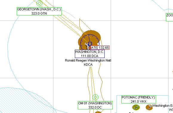
| ATIS Frequency | 132.65 MHz |
| Clearance Delivery | 128.25 MHz |
| Ground Frequency | 121.70 MHz |
| Tower Frequency | 119.10 MHz |
| Departure Frequency | 118.95 MHz 121.05 MHz 125.65 MHz |
| Departure Frequency | 126.55 MHz |
| Approach Frequency | 118.30 MHz 124.70 MHz 119.00 MHz |
| Approach Frequency | 119.70 MHz 119.85 MHz 120.45 MHz |
| Approach Frequency | 124.20 MHz 124.55 MHz 124.65 MHz |
| Approach Frequency | 126.10 MHz 128.70 MHz |
| UNICOM Frequency | 122.95 MHz |
| AWOS Frequency | 128.80 MHz |
| Altitude | 16 ft |
| Mag. Variation | 9.7 deg |
| Lat/Lon | N38°51.13' W077°02.26' |
| Rwy ILS/GS/DME 1 IDCA | |
| Airport | Ronald Reagan Washington Natl |
| ILS Frequ./Range | 109.90 MHz 27 nm |
| Approach course | 5 deg |
| Glideslope altitude | 1600 ft at 5 nm distance |
| Altitude/Surface | 16 ft Asphalt |
| Length/Width | 6875 ft 150 ft |
| Runway 19 | |
| Airport | Ronald Reagan Washington Natl |
| Approach course | 185 deg |
| Altitude/Surface | 16 ft Asphalt |
| Length/Width | 6875 ft 150 ft |
| Runway 4 | |
| Airport | Ronald Reagan Washington Natl |
| Approach course | 35 deg |
| Altitude/Surface | 16 ft Asphalt |
| Length/Width | 4914 ft 150 ft |
| Runway 22 | |
| Airport | Ronald Reagan Washington Natl |
| Approach course | 215 deg |
| Altitude/Surface | 16 ft Asphalt |
| Length/Width | 4914 ft 150 ft |
| Runway 15 | |
| Airport | Ronald Reagan Washington Natl |
| Approach course | 152 deg |
| Altitude/Surface | 16 ft Asphalt |
| Length/Width | 5190 ft 150 ft |
| Runway 33 | |
| Airport | Ronald Reagan Washington Natl |
| Approach course | 332 deg |
| Altitude/Surface | 16 ft Asphalt |
| Length/Width | 5190 ft 150 ft |
| ILS/GS/DME IVWH | |
| Airport | Ronald Reagan Washington Natl |
| Frequ./Range | 108.50 MHz 27 nm |
| Approach course | 145 deg |
| Glideslope altitude | 1600 ft at 5 nm distance |
| Altitude | 16 ft |
| ILS/GS/DME IASO | |
| Airport | Ronald Reagan Washington Natl |
| Frequ./Range | 109.90 MHz 27 nm |
| Approach course | 147 deg |
| Glideslope altitude | 1600 ft at 5 nm distance |
| Altitude | 16 ft |
ABOUT THE FLIGHT
Follow the ATC
instructions. Head to the airport, land on the assigned runway, and taxi to the
parking area of your choice.
There is no flight plan associated with this Flight, so no course line will show
up in the GPS and there won't be any information in the Navigation Log.
NOTE
For variety, you can re-fly this Flight with a different aircraft, at a
different time or in a different season or with different weather conditions.
For maximum realism, use the Real-World Weather feature.