© 2006 Perfect Flight - Created by Marco Martini
All rights reserved
ESTIMATED TIME TO COMPLETE
20 minutes
AIRPORT FACILITY - Terminal Procedures Publication
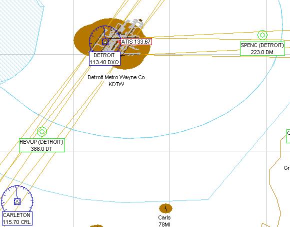
KDTW - Detroit Metro Wayne Co
Adventure
© 2006 Perfect Flight - Created by Marco Martini
All rights reserved
ESTIMATED TIME TO COMPLETE
20 minutes
AIRPORT FACILITY -
Terminal Procedures Publication
| Airport KDTW | |
| Full name | Detroit Metro Wayne Co |
| City | Detroit |
| State | Michigan |
| Country | United States |
| ATIS Frequency | 133.67 MHz |
| Clearance Delivery | 120.65 MHz |
| Ground Frequency | 119.45 MHz 121.80 MHz 132.72 MHz |
| Tower Frequency | 118.40 MHz 135.00 MHz |
| Departure Frequency | 118.57 MHz 118.95 MHz 125.52 MHz |
| Departure Frequency | 132.02 MHz 134.30 MHz |
| Approach Frequency | 118.57 MHz 124.05 MHz 125.15 MHz |
| Approach Frequency | 118.95 MHz 124.90 MHz 126.85 MHz |
| Approach Frequency | 134.30 MHz |
| FSS Frequency | 122.10 MHz |
| UNICOM Frequency | 122.95 MHz |
| Altitude | 646 ft |
| Mag. Variation | 5.6 deg |
| Lat/Lon | N42°12.75' W083°21.20' |
| Rwy ILS/GS/DME 4L IHJT | |
| Airport | Detroit Metro Wayne Co |
| ILS Frequ./Range | 111.95 MHz 27 nm |
| Approach course | 34 deg |
| Glideslope altitude | 2200 ft at 5 nm distance |
| Altitude/Surface | 646 ft Concrete |
| Length/Width | 10002 ft 150 ft |
| Rwy ILS/GS/DME 22R IJKI | |
| Airport | Detroit Metro Wayne Co |
| ILS Frequ./Range | 111.95 MHz 27 nm |
| Approach course | 214 deg |
| Glideslope altitude | 2200 ft at 5 nm distance |
| Altitude/Surface | 646 ft Concrete |
| Length/Width | 10002 ft 150 ft |
| Rwy ILS/GS/DME 4R IDTW | |
| Airport | Detroit Metro Wayne Co |
| ILS Frequ./Range | 110.70 MHz 27 nm |
| Approach course | 34 deg |
| Glideslope altitude | 2200 ft at 5 nm distance |
| Altitude/Surface | 646 ft Concrete |
| Length/Width | 12001 ft 200 ft |
| Rwy ILS/GS/DME 22L IDWC | |
| Airport | Detroit Metro Wayne Co |
| ILS Frequ./Range | 110.70 MHz 27 nm |
| Approach course | 214 deg |
| Glideslope altitude | 2200 ft at 5 nm distance |
| Altitude/Surface | 646 ft Concrete |
| Length/Width | 12001 ft 200 ft |
| Runway 3L | |
| Airport | Detroit Metro Wayne Co |
| Approach course | 34 deg |
| Altitude/Surface | 646 ft Asphalt |
| Length/Width | 8499 ft 200 ft |
| Runway 21R | |
| Airport | Detroit Metro Wayne Co |
| Approach course | 214 deg |
| Altitude/Surface | 646 ft Asphalt |
| Length/Width | 8499 ft 200 ft |
| Rwy ILS/GS 3R IHUU | |
| Airport | Detroit Metro Wayne Co |
| ILS Frequ./Range | 111.50 MHz 27 nm |
| Approach course | 34 deg |
| Glideslope altitude | 2200 ft at 5 nm distance |
| Altitude/Surface | 646 ft Concrete |
| Length/Width | 9999 ft 150 ft |
| Rwy ILS/GS 21L IEJR | |
| Airport | Detroit Metro Wayne Co |
| ILS Frequ./Range | 111.50 MHz 27 nm |
| Approach course | 214 deg |
| Glideslope altitude | 2200 ft at 5 nm distance |
| Altitude/Surface | 646 ft Concrete |
| Length/Width | 9999 ft 150 ft |
| Runway 9R | |
| Airport | Detroit Metro Wayne Co |
| Approach course | 94 deg |
| Altitude/Surface | 646 ft Concrete |
| Length/Width | 8486 ft 150 ft |
| Rwy ILS/GS 27L IEPA | |
| Airport | Detroit Metro Wayne Co |
| ILS Frequ./Range | 110.15 MHz 27 nm |
| Approach course | 274 deg |
| Glideslope altitude | 2200 ft at 5 nm distance |
| Altitude/Surface | 646 ft Concrete |
| Length/Width | 8486 ft 150 ft |
| Runway 9L | |
| Airport | Detroit Metro Wayne Co |
| Approach course | 94 deg |
| Altitude/Surface | 646 ft Asphalt |
| Length/Width | 8686 ft 200 ft |
| Rwy ILS/GS 27R IDMI | |
| Airport | Detroit Metro Wayne Co |
| ILS Frequ./Range | 108.50 MHz 27 nm |
| Approach course | 274 deg |
| Glideslope altitude | 2200 ft at 5 nm distance |
| Altitude/Surface | 646 ft Asphalt |
| Length/Width | 8686 ft 200 ft |
ABOUT THE FLIGHT
Follow the ATC
instructions. Head to the airport, land on the assigned runway, and taxi to the
parking area of your choice.
There is no flight plan associated with this Flight, so no course line will show
up in the GPS and there won't be any information in the Navigation Log.
NOTE
For variety, you can re-fly this Flight with a different aircraft, at a
different time or in a different season or with different weather conditions.
For maximum realism, use the Real-World Weather feature.