© 2006 Perfect Flight - Created by Marco Martini
All rights reserved
ESTIMATED TIME TO COMPLETE
20 minutes
AIRPORT FACILITY - Terminal Procedures Publication
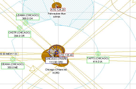
KORD - Chicago O Hare Intl
Adventure
© 2006 Perfect Flight - Created by Marco Martini
All rights reserved
ESTIMATED TIME TO COMPLETE
20 minutes
AIRPORT FACILITY -
Terminal Procedures Publication
| Airport KORD | |
| Full name | Chicago-O'Hare Intl |
| City | Chicago |
| State | Illinois |
| Country | United States |
| ATIS Frequency | 135.40 MHz |
| Clearance Delivery | 119.25 MHz 121.60 MHz |
| Ground Frequency | 121.67 MHz 121.75 MHz 121.90 MHz |
| Ground Frequency | 129.05 MHz |
| Tower Frequency | 120.75 MHz 126.90 MHz 127.92 MHz |
| Tower Frequency | 132.70 MHz |
| Departure Frequency | 125.00 MHz 125.40 MHz 127.40 MHz |
| Approach Frequency | 119.00 MHz 121.15 MHz 124.35 MHz |
| Approach Frequency | 125.70 MHz 128.45 MHz 120.55 MHz |
| Approach Frequency | 133.10 MHz 133.50 MHz |
| UNICOM Frequency | 122.95 MHz |
| Altitude | 669 ft |
| Mag. Variation | 1.0 deg |
| Lat/Lon | N41°58.78' W087°54.25' |
| Rwy ILS/GS/DME 14R IORD | |
| Airport | Chicago-O'Hare Intl |
| ILS Frequ./Range | 109.75 MHz 27 nm |
| Approach course | 141 deg |
| Glideslope altitude | 2300 ft at 5 nm distance |
| Altitude/Surface | 669 ft Asphalt |
| Length/Width | 12996 ft 200 ft |
| Rwy ILS/GS/DME 32L IRVG | |
| Airport | Chicago-O'Hare Intl |
| ILS Frequ./Range | 108.95 MHz 27 nm |
| Approach course | 321 deg |
| Glideslope altitude | 2300 ft at 5 nm distance |
| Altitude/Surface | 669 ft Asphalt |
| Length/Width | 12996 ft 200 ft |
| Rwy ILS/GS/DME 9R IMED | |
| Airport | Chicago-O'Hare Intl |
| ILS Frequ./Range | 111.10 MHz 27 nm |
| Approach course | 91 deg |
| Glideslope altitude | 2200 ft at 5 nm distance |
| Altitude/Surface | 669 ft Asphalt |
| Length/Width | 10125 ft 150 ft |
| Rwy ILS/GS/DME 9R IMED | |
| Airport | Chicago-O'Hare Intl |
| ILS Frequ./Range | 111.10 MHz 27 nm |
| Approach course | 91 deg |
| Glideslope altitude | 2200 ft at 5 nm distance |
| Altitude/Surface | 669 ft Asphalt |
| Length/Width | 10125 ft 150 ft |
| Rwy ILS/GS/DME 9R IMED | |
| Airport | Chicago-O'Hare Intl |
| ILS Frequ./Range | 111.10 MHz 27 nm |
| Approach course | 91 deg |
| Glideslope altitude | 2200 ft at 5 nm distance |
| Altitude/Surface | 669 ft Asphalt |
| Length/Width | 10125 ft 150 ft |
| Rwy ILS/GS/DME 27L ITSL | |
| Airport | Chicago-O'Hare Intl |
| ILS Frequ./Range | 111.10 MHz 27 nm |
| Approach course | 271 deg |
| Glideslope altitude | 2300 ft at 5 nm distance |
| Altitude/Surface | 669 ft Asphalt |
| Length/Width | 10125 ft 150 ft |
| Rwy ILS/GS/DME 14L IOHA | |
| Airport | Chicago-O'Hare Intl |
| ILS Frequ./Range | 110.90 MHz 27 nm |
| Approach course | 141 deg |
| Glideslope altitude | 2300 ft at 5 nm distance |
| Altitude/Surface | 669 ft Asphalt |
| Length/Width | 9999 ft 150 ft |
| Rwy ILS/GS 32R IIDN | |
| Airport | Chicago-O'Hare Intl |
| ILS Frequ./Range | 110.75 MHz 27 nm |
| Approach course | 321 deg |
| Glideslope altitude | 2300 ft at 5 nm distance |
| Altitude/Surface | 669 ft Asphalt |
| Length/Width | 9999 ft 150 ft |
| Rwy ILS/GS 4R IFJU | |
| Airport | Chicago-O'Hare Intl |
| ILS Frequ./Range | 110.10 MHz 27 nm |
| Approach course | 42 deg |
| Glideslope altitude | 2300 ft at 5 nm distance |
| Altitude/Surface | 669 ft Asphalt |
| Length/Width | 8068 ft 150 ft |
| Rwy ILS/GS 22L ILQQ | |
| Airport | Chicago-O'Hare Intl |
| ILS Frequ./Range | 110.10 MHz 27 nm |
| Approach course | 222 deg |
| Glideslope altitude | 2300 ft at 5 nm distance |
| Altitude/Surface | 669 ft Asphalt |
| Length/Width | 8068 ft 150 ft |
| Rwy ILS/GS 9L IJAV | |
| Airport | Chicago-O'Hare Intl |
| ILS Frequ./Range | 110.50 MHz 27 nm |
| Approach course | 91 deg |
| Glideslope altitude | 2300 ft at 5 nm distance |
| Altitude/Surface | 669 ft Asphalt |
| Length/Width | 7954 ft 150 ft |
| Rwy ILS/GS 27R IIAC | |
| Airport | Chicago-O'Hare Intl |
| ILS Frequ./Range | 110.50 MHz 27 nm |
| Approach course | 271 deg |
| Glideslope altitude | 2300 ft at 5 nm distance |
| Altitude/Surface | 669 ft Asphalt |
| Length/Width | 7954 ft 150 ft |
| Rwy ILS 4L IHNA | |
| Airport | Chicago-O'Hare Intl |
| ILS Frequ./Range | 111.30 MHz 27 nm |
| Approach course | 40 deg |
| Altitude/Surface | 669 ft Asphalt |
| Length/Width | 7497 ft 150 ft |
| Rwy ILS/GS 22R IRXZ | |
| Airport | Chicago-O'Hare Intl |
| ILS Frequ./Range | 111.30 MHz 27 nm |
| Approach course | 220 deg |
| Glideslope altitude | 2300 ft at 5 nm distance |
| Altitude/Surface | 669 ft Asphalt |
| Length/Width | 7497 ft 150 ft |
| Runway 18 | |
| Airport | Chicago-O'Hare Intl |
| Approach course | 181 deg |
| Altitude/Surface | 669 ft Asphalt |
| Length/Width | 5343 ft 150 ft |
| Runway 36 | |
| Airport | Chicago-O'Hare Intl |
| Approach course | 1 deg |
| Altitude/Surface | 669 ft Asphalt |
| Length/Width | 5343 ft 150 ft |
ABOUT THE FLIGHT
Follow the ATC
instructions. Head to the airport, land on the assigned runway, and taxi to the
parking area of your choice.
There is no flight plan associated with this Flight, so no course line will show
up in the GPS and there won't be any information in the Navigation Log.
NOTE
For variety, you can re-fly this Flight with a different aircraft, at a
different time or in a different season or with different weather conditions.
For maximum realism, use the Real-World Weather feature.