© 2006 Perfect Flight - Created by Marco Martini
All rights reserved
ESTIMATED TIME TO COMPLETE
20 minutes
AIRPORT FACILITY - Terminal Procedures Publication
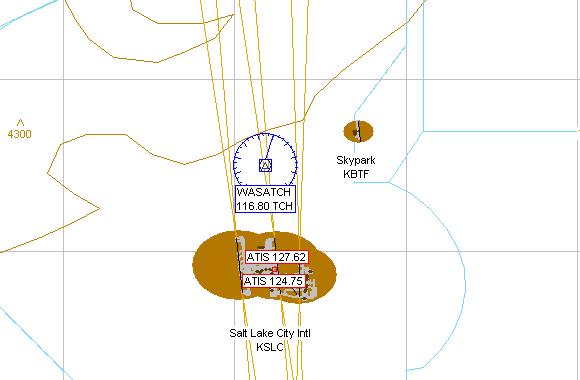
KSLC - Salt Lake City Intl
Adventure
© 2006 Perfect Flight - Created by Marco Martini
All rights reserved
ESTIMATED TIME TO COMPLETE
20 minutes
AIRPORT FACILITY -
Terminal Procedures Publication
| Airport KSLC | |
| Full name | Salt Lake City Intl |
| City | Salt Lake City |
| State | Utah |
| Country | United States |
| ATIS Frequency | 124.75 MHz 127.62 MHz |
| Clearance Delivery | 127.30 MHz |
| Ground Frequency | 121.90 MHz 133.65 MHz |
| Tower Frequency | 118.30 MHz 119.05 MHz 132.65 MHz |
| Departure Frequency | 120.90 MHz 121.10 MHz 124.30 MHz |
| Departure Frequency | 124.90 MHz 126.25 MHz 128.10 MHz |
| Departure Frequency | 135.50 MHz |
| Approach Frequency | 120.90 MHz 121.10 MHz 124.30 MHz |
| Approach Frequency | 124.90 MHz 126.25 MHz 128.10 MHz |
| Approach Frequency | 135.50 MHz |
| FSS Frequency | 122.40 MHz |
| UNICOM Frequency | 122.95 MHz |
| Altitude | 4225 ft |
| Mag. Variation | -14.5 deg |
| Lat/Lon | N40°47.30' W111°58.67' |
| Rwy ILS/GS/DME 16L IMOY | |
| Airport | Salt Lake City Intl |
| ILS Frequ./Range | 109.50 MHz 27 nm |
| Approach course | 160 deg |
| Glideslope altitude | 5800 ft at 5 nm distance |
| Altitude/Surface | 4225 ft Asphalt |
| Length/Width | 12011 ft 150 ft |
| Rwy ILS/GS/DME 34R ISLC | |
| Airport | Salt Lake City Intl |
| ILS Frequ./Range | 109.50 MHz 27 nm |
| Approach course | 340 deg |
| Glideslope altitude | 5800 ft at 5 nm distance |
| Altitude/Surface | 4225 ft Asphalt |
| Length/Width | 12011 ft 150 ft |
| Rwy ILS/GS/DME 16R IUAT | |
| Airport | Salt Lake City Intl |
| ILS Frequ./Range | 111.90 MHz 27 nm |
| Approach course | 160 deg |
| Glideslope altitude | 5800 ft at 5 nm distance |
| Altitude/Surface | 4225 ft Concrete |
| Length/Width | 12006 ft 150 ft |
| Rwy ILS/GS/DME 34L IUUH | |
| Airport | Salt Lake City Intl |
| ILS Frequ./Range | 111.90 MHz 27 nm |
| Approach course | 340 deg |
| Glideslope altitude | 5800 ft at 5 nm distance |
| Altitude/Surface | 4225 ft Concrete |
| Length/Width | 12006 ft 150 ft |
| Rwy ILS/GS/DME 17 IBNT | |
| Airport | Salt Lake City Intl |
| ILS Frequ./Range | 111.50 MHz 27 nm |
| Approach course | 165 deg |
| Glideslope altitude | 5800 ft at 5 nm distance |
| Altitude/Surface | 4225 ft Asphalt |
| Length/Width | 9602 ft 150 ft |
| Rwy ILS/GS 35 IUTJ | |
| Airport | Salt Lake City Intl |
| ILS Frequ./Range | 110.10 MHz 27 nm |
| Approach course | 345 deg |
| Glideslope altitude | 5800 ft at 5 nm distance |
| Altitude/Surface | 4225 ft Asphalt |
| Length/Width | 9602 ft 150 ft |
| Runway 14 | |
| Airport | Salt Lake City Intl |
| Approach course | 139 deg |
| Altitude/Surface | 4225 ft Asphalt |
| Length/Width | 4892 ft 150 ft |
| Runway 32 | |
| Airport | Salt Lake City Intl |
| Approach course | 319 deg |
| Altitude/Surface | 4225 ft Asphalt |
| Length/Width | 4892 ft 150 ft |
ABOUT THE FLIGHT
Follow the ATC
instructions. Head to the airport, land on the assigned runway, and taxi to the
parking area of your choice.
There is no flight plan associated with this Flight, so no course line will show
up in the GPS and there won't be any information in the Navigation Log.
NOTE
For variety, you can re-fly this Flight with a different aircraft, at a
different time or in a different season or with different weather conditions.
For maximum realism, use the Real-World Weather feature.