© 2006 Perfect Flight - Created by Marco Martini
All rights reserved
ESTIMATED TIME TO COMPLETE
20 minutes
AIRPORT FACILITY - Terminal Procedures Publication
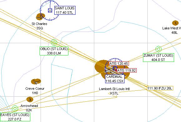
KSTL - Lambert St Louis Intl
Adventure
© 2006 Perfect Flight - Created by Marco Martini
All rights reserved
ESTIMATED TIME TO COMPLETE
20 minutes
AIRPORT FACILITY -
Terminal Procedures Publication
| Airport KSTL | |
| Full name | Lambert-St Louis Intl |
| City | St Louis |
| State | Missouri |
| Country | United States |
| ATIS Frequency | 119.92 MHz 120.45 MHz |
| Clearance Delivery | 119.50 MHz |
| Ground Frequency | 121.65 MHz 121.90 MHz 127.55 MHz |
| Tower Frequency | 118.50 MHz 120.05 MHz |
| Departure Frequency | 119.15 MHz 120.05 MHz 124.25 MHz |
| Departure Frequency | 126.55 MHz 128.10 MHz |
| Approach Frequency | 120.05 MHz 123.70 MHz 132.13 MHz |
| Approach Frequency | 133.55 MHz 124.20 MHz 126.50 MHz |
| FSS Frequency | 122.60 MHz |
| MULTICOMM Frequ. | 123.20 MHz |
| UNICOM Frequency | 122.95 MHz |
| Altitude | 603 ft |
| Mag. Variation | -1.4 deg |
| Lat/Lon | N38°44.86' W090°21.60' |
| Rwy ILS/GS 12R ILMR | |
| Airport | Lambert-St Louis Intl |
| ILS Frequ./Range | 109.70 MHz 27 nm |
| Approach course | 121 deg |
| Glideslope altitude | 2200 ft at 5 nm distance |
| Altitude/Surface | 603 ft Concrete |
| Length/Width | 11032 ft 200 ft |
| Rwy ILS/GS 30L IBKY | |
| Airport | Lambert-St Louis Intl |
| ILS Frequ./Range | 111.50 MHz 27 nm |
| Approach course | 301 deg |
| Glideslope altitude | 2200 ft at 5 nm distance |
| Altitude/Surface | 603 ft Concrete |
| Length/Width | 11032 ft 200 ft |
| Rwy ILS/GS/DME 6 IJAK | |
| Airport | Lambert-St Louis Intl |
| ILS Frequ./Range | 110.30 MHz 27 nm |
| Approach course | 61 deg |
| Glideslope altitude | 2200 ft at 5 nm distance |
| Altitude/Surface | 603 ft Concrete |
| Length/Width | 7595 ft 150 ft |
| Rwy ILS/GS/DME 24 ISTL | |
| Airport | Lambert-St Louis Intl |
| ILS Frequ./Range | 110.30 MHz 27 nm |
| Approach course | 241 deg |
| Glideslope altitude | 2200 ft at 5 nm distance |
| Altitude/Surface | 603 ft Concrete |
| Length/Width | 7595 ft 150 ft |
| Rwy ILS/GS/DME 12L ILDZ | |
| Airport | Lambert-St Louis Intl |
| ILS Frequ./Range | 108.90 MHz 27 nm |
| Approach course | 121 deg |
| Glideslope altitude | 2200 ft at 5 nm distance |
| Altitude/Surface | 603 ft Concrete |
| Length/Width | 8996 ft 150 ft |
| Rwy ILS/GS/DME 30R ISJW | |
| Airport | Lambert-St Louis Intl |
| ILS Frequ./Range | 111.30 MHz 27 nm |
| Approach course | 301 deg |
| Glideslope altitude | 2200 ft at 5 nm distance |
| Altitude/Surface | 603 ft Concrete |
| Length/Width | 8996 ft 150 ft |
| Runway 13 | |
| Airport | Lambert-St Louis Intl |
| Approach course | 121 deg |
| Altitude/Surface | 603 ft Asphalt |
| Length/Width | 6284 ft 75 ft |
| Runway 31 | |
| Airport | Lambert-St Louis Intl |
| Approach course | 301 deg |
| Altitude/Surface | 603 ft Asphalt |
| Length/Width | 6284 ft 75 ft |
| Runway 17 | |
| Airport | Lambert-St Louis Intl |
| Approach course | 178 deg |
| Altitude/Surface | 603 ft Asphalt |
| Length/Width | 2880 ft 75 ft |
| Runway 35 | |
| Airport | Lambert-St Louis Intl |
| Approach course | 358 deg |
| Altitude/Surface | 603 ft Asphalt |
| Length/Width | 2880 ft 75 ft |
ABOUT THE FLIGHT
Follow the ATC
instructions. Head to the airport, land on the assigned runway, and taxi to the
parking area of your choice.
There is no flight plan associated with this Flight, so no course line will show
up in the GPS and there won't be any information in the Navigation Log.
NOTE
For variety, you can re-fly this Flight with a different aircraft, at a
different time or in a different season or with different weather conditions.
For maximum realism, use the Real-World Weather feature.